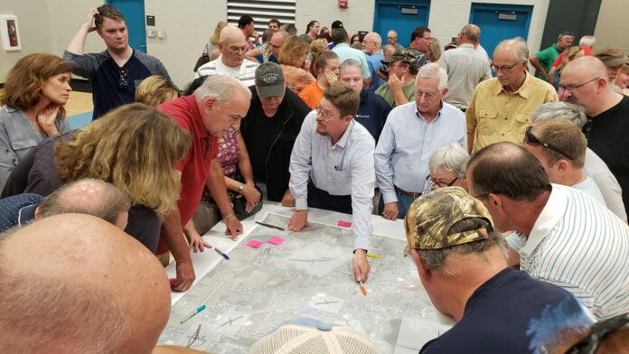
It was a packed house in the Lincoln Elementary School gymnasium Wednesday night.
Roughly 900 people packed the bleachers in the gym to hear officials speak from both the city of Warsaw and Kosciusko County. The meeting was the second to be held on the project.
Warsaw Mayor Joe Thallemer, City Planner Jeremy Skinner, Kosciusko County Commissioner Cary Groninger, Michiana Area Council of Governments Chair Phil Jenkins and other officials spoke to the crowd about the project.
Thallemer went over some statistics to start the meeting which featured the two proposed routes, a north and south route. Concerns that were brought up were that if a north route was taken, it would impact industry and the airport, and the impact with the airport could potentially take the route even further north. The south route would impact hundreds of acres of farm land, impacting families there, including some generational farmers who spoke at the meeting.
Crash statistics were also featured, showing that crashes since 2011 have gone up on many stretches of US 30. Areas around Fox Farm Road and Parker Street have shown some of the highest increases of crashes in that time. One intersection that has seen a decrease in crashes is US 30 and State Road 15, which Thallemer said is considered a “controlled intersection.”
Following the first half of officials speaking, attendees broke down into workshops, where four tables were set up, each having a large detailed map, and each station had a different official there to talk to the attendees.
A public comment session followed the workshop for 30 minutes, where different people spoke about the project.
A lot of the opposition came for the southern tier route, which many people voiced that hundreds of acres of farm land would be impacted. One speaker spoke on how her family has a generational farm, and the highway would cut off roughly 20 acres of it. Another spoke about the issues that would come upon farmers moving their equipment around and how planting would be affected and divided by the highway. The next speaker talked about the crash data that Thallemer mentioned earlier in the meeting, and those traffic issues would follow the route no matter where it goes, even as a freeway.
Bob Conley, Kosciusko County Commissioner for the southern district, spoke about the traffic impacts. Conley talked about the number of overpasses that would have to be built because of the numerous county roads, State Roads 25 and 15, and several railroads. He said that many of the county roads may even just come to a dead end and those that frequent those roads would have to take detours that could be miles away.
Several people voiced their idea of an “elevated highway” on the existing road that goes through town. The idea would utilize the idea of ramps at strategic intersections, such as State Road 15, Parker Street and East Center Street. Another thought brought forward was making access roads parallel to the highway with one main ramp in each direction to access all the roads, and one ramp to get back on the highway. An example of this would be a stretch of US 31 that goes through Westfield, north of Indianapolis, between State Road 32 and Keystone Parkway.
A couple people spoke about the northern tier proposal and the impacts it would have on the industry, with companies such as Zimmer Biomet, Da-Lite and Tecomet, the shopping areas and the Warsaw Airport. Another chimed in that the airport would probably make INDOT rethink their route, but it would take it further north and make travel times even longer.
Another popular comment was regarding the amount of traffic flow currently along US 30, and how the Indiana Toll Road has changed it. Jenkins from MACOG said they have noticed an increase in the amount of traffic along the route and it could be from the tolls doubling in recent years along Interstate 80/90. Some comments noted the increased truck traffic along the route. Several were asking for daily traffic figures on the toll road, but no one had those numbers because they have not been released by the company who leases the toll road.
Officials told everyone that their opinion on the matters are a big help for INDOT’s impact studies on the project. Thallemer told the audience, “Without your input, (INDOT) could just come in and say, ‘This is the plan, here is where and what we are doing, this is how much its going to cost.'”
Warsaw City Planner Jeremy Skinner added, “When you look over these maps, think of the impacts you would face if you are a farmer, if you are a homeowner, if you are a business owner. Think about how you would utilize the road. What are the (pros and cons) if it goes south? Or if it goes north? If it continues to go through town? The more information you provide, the better you can help this plan, or those other impacts? This would help INDOT when they look into their impact study.”
They went on to say that any construction could still be ten years out and the completion of any project could be another five or six years after that.


